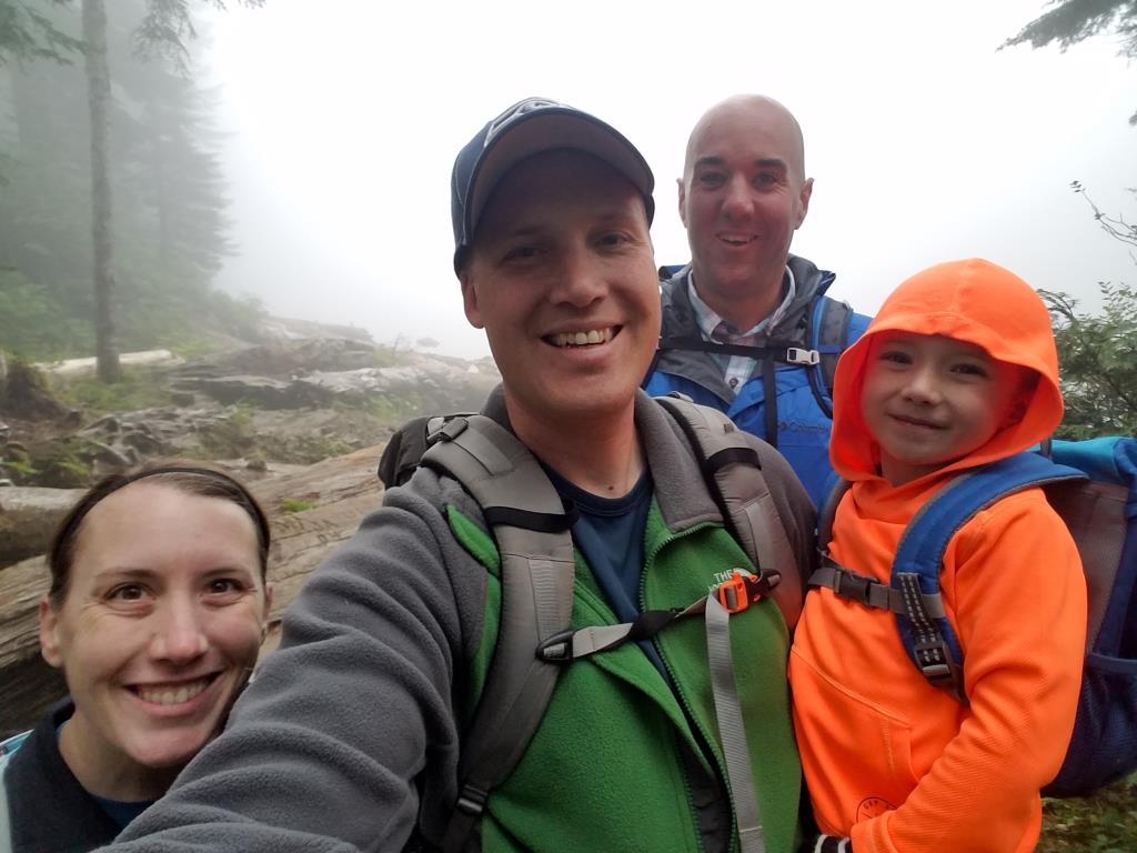
In 2010, Tyla and I attempted to drive up a forestry road off of the Mountain Loop Highway but got turned around by snow. This past weekend, I finally got to attempt it again. Logan, Tyla, Elijah and I headed up there to hike to Coal and Independence Lakes.
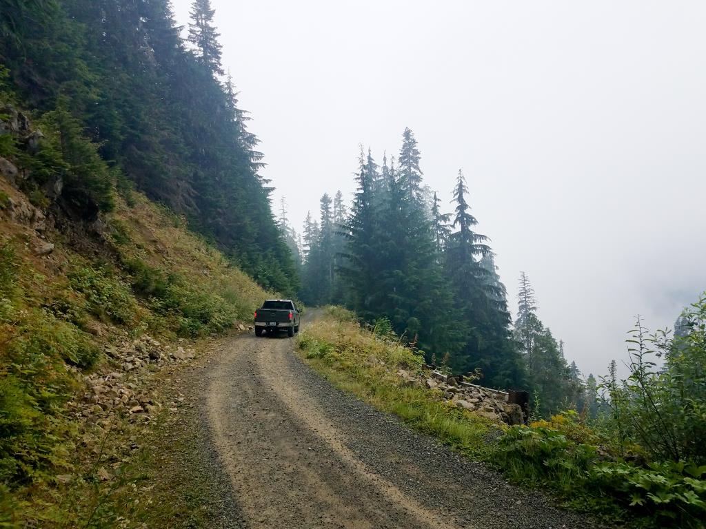
The drive up the forest road is one of the highlights of the trip for me. It’s not for the faint of heart (or the low of ground clearance.) Much of the road is a single lane with no space for two cars to pass unless one is willing to plunge many hundred feet down the mountain. I was happy to have plenty of ground clearance though we never needed four wheel drive.
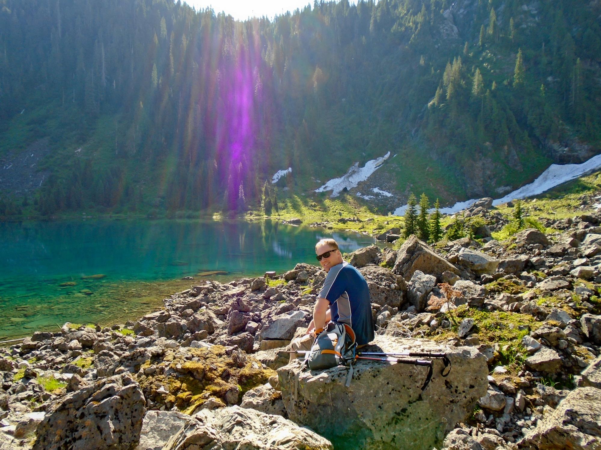
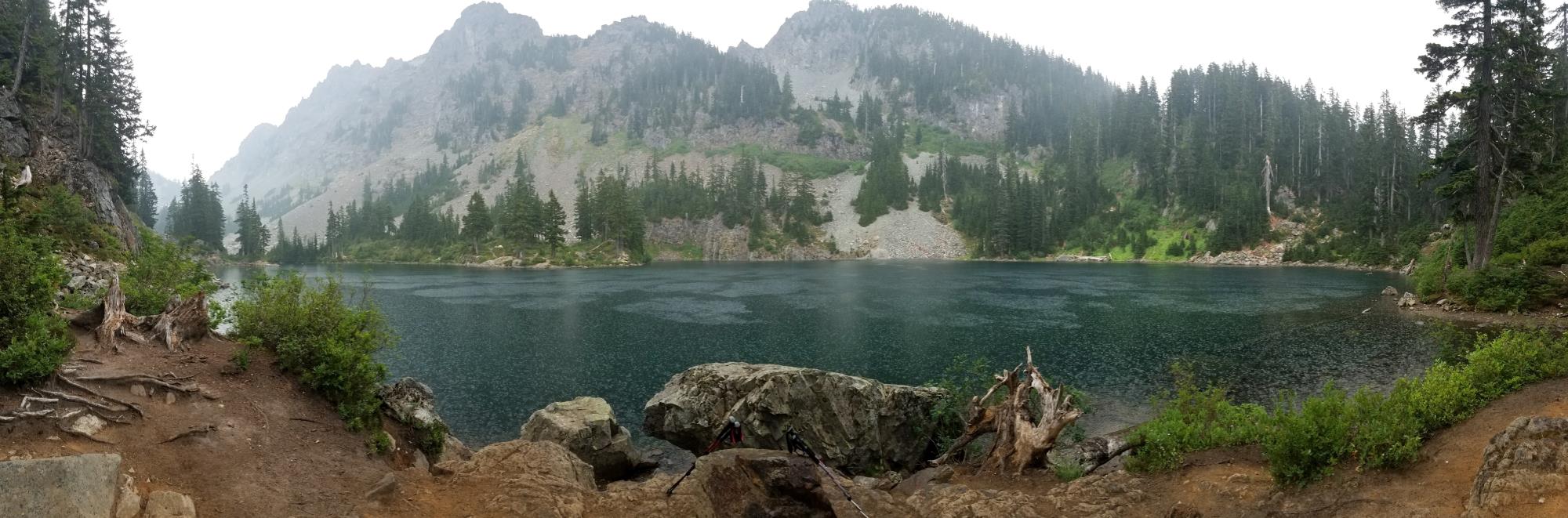
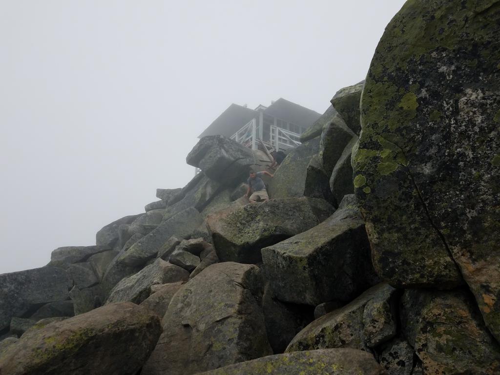
We parked at the first parking lot, walked up the trail and immediately found Coal Lake. There wasn’t much to see because the whole mountain was enshrouded in a cloud. That’s when I looked at the map and realized that we hadn’t actually hit the end of the road where the Independence Lake trailhead is, so we hopped back in the truck and drove a couple more minutes to the end of the road.
It’s only about a mile to the lake, but it took us ~40 minutes because Elijah had a tough time climbing up and over all the big rocks and roots that were in the trail. On the way back, I carried his hiking pole and we made it back in just about half the time. I think he gets distracted by where to place the pole sometimes.
Independence Lake was disappointing as we couldn’t see anything due to the fog/clouds. The trail goes on to North Lake but that’s not something Elijah would be able to handle so we had a little snack and turned around.
I don’t think Elijah was all too thrilled but I enjoyed it. I loved being on a hike that wasn’t crowded with people in flip flops carrying tiny dogs. I want to go back again on a clearer day and hopefully make it to North Lake as well.
A few pictures are included below along with our dashcam video of the drive up the road.
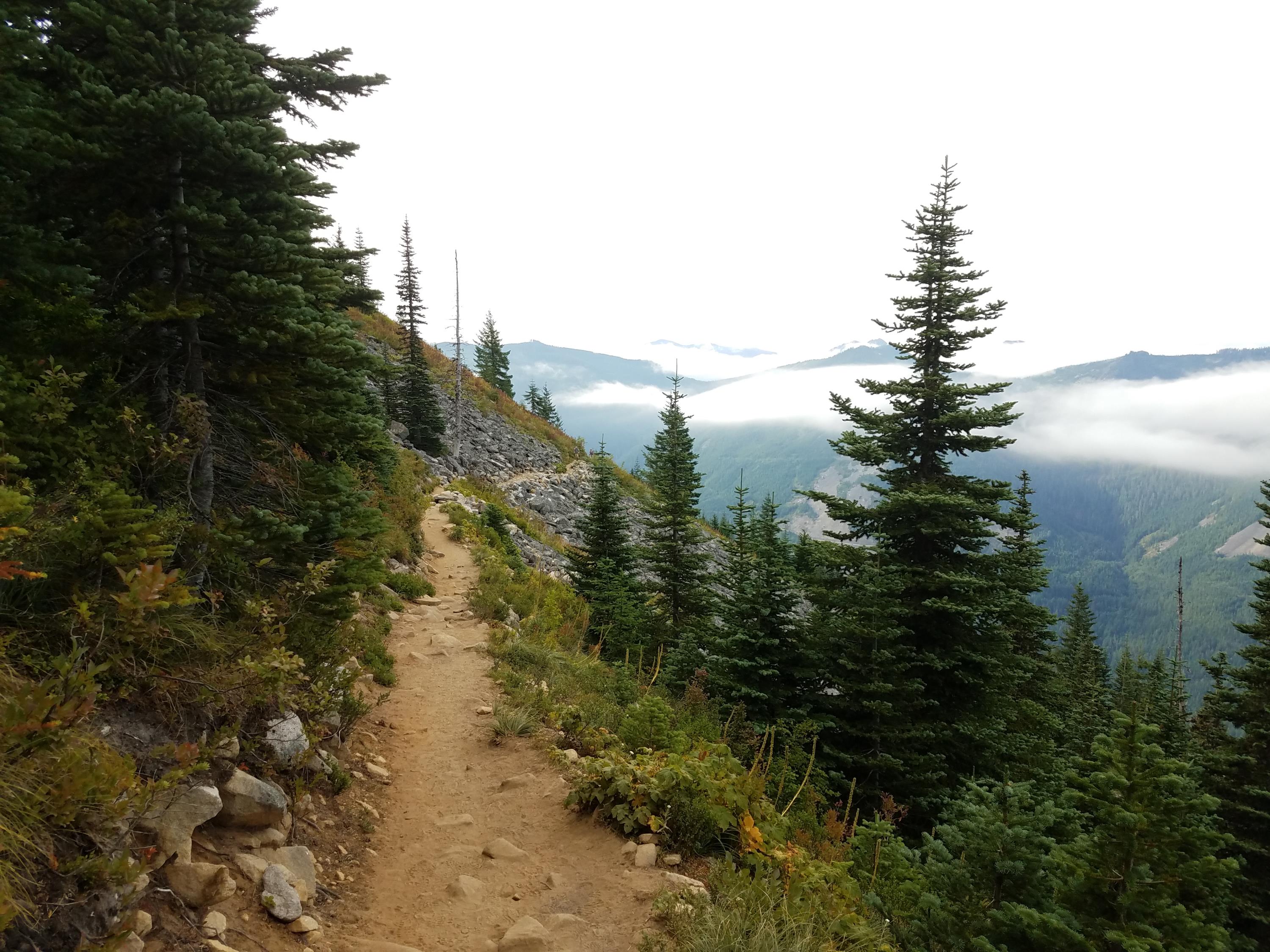
Lake 22 is one of the more popular and well-known hikes in the area. That’s usually for a good reason so Logan and I decided to check it out. Popular also usually means “crowded trail” so even with a ~75 minute drive to the trailhead, we were on the trail by 7:20am. Most of the hike is on rock either because it was naturally there or because it was placed there to help avoid damage from the endless streams of water that cross the trail. It’s 2.7 miles and 1350 feet to the lake, but we added some more by walking around the whole lake. I highly recommend that as the opposite end of the lake has a great view looking almost straight up a huge rock face. Our trip down took quite a while as we stepped aside for the never ending stream of people coming up. While we both enjoyed the hike, it’s not very high on our repeat list. There are so many other great hikes with fewer crowds.
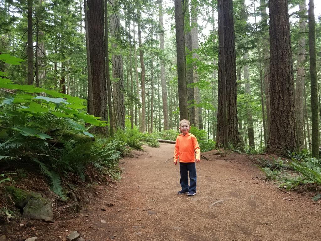
Up until this year, I’ve been carrying Elijah in a hiking backpack when I go on hikes. He finally got too big for it, so this is the year he transitions to walking. While I enjoyed being able to take more adventurous hikes last year, I’m excited to see if he’s still interested in hiking when he has to do the walking.
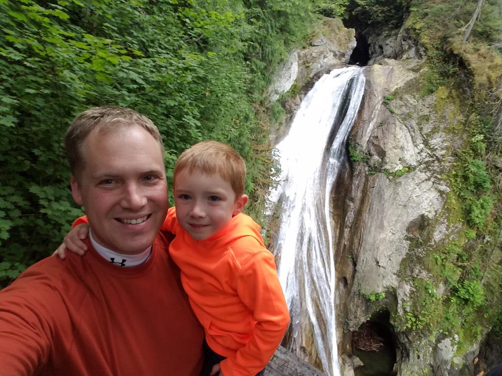
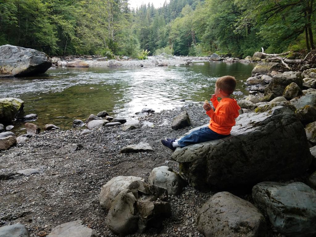
I decided to start off with Twin Falls for his first hike. I believe I’ve done it three times before and there is a lot to see along the whole trail. It starts off following a river, climbs up a hill through some big rocks and then quickly ends up at the falls. He did great on the entire hike, never complaining. I had told him that he could say when he wants to turn around and he asked for that about a tenth of a mile from the first waterfall. I encouraged him to keep going and we made it. That first set of falls has about 100 stairs going down to a great lookout, so I told him that if he walked down, I’d carry him back up. We didn’t make it to the bridge a little farther up the trail but I’m still calling it a success because, other than the stairs, I never had to carry him. He hiked quite a bit faster than some older kids who started at the same time as us too. I didn’t have my Garmin watch with me, but I’d guess we covered about 2.5 miles.
He hasn’t asked for another hike yet, but I’m hoping to get him out at least once more. I picked up a hiking with kids book to get some good ideas. Maybe next time I’ll work on picking out clothing that doesn’t clash so badly.
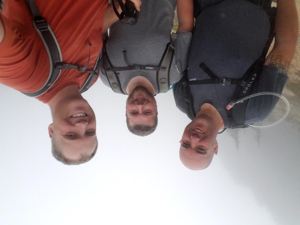
It all started at the church Christmas party in December. Logan was talking to DaveK about his incredible weight loss and he mentioned that getting up to Camp Muir was his “man mission.” Dave said, “Great! Let’s do it!” That’s the point where I walked up and said, “I’m in. What are we doing?” “Camp Muir!”
Fast forward to August and I was waking up at 4am to meet Logan, Dave, TimK, and Pastor for the drive down to Paradise. We arrived in the parking lot at 7:45 and we were on the trail by 8:15.
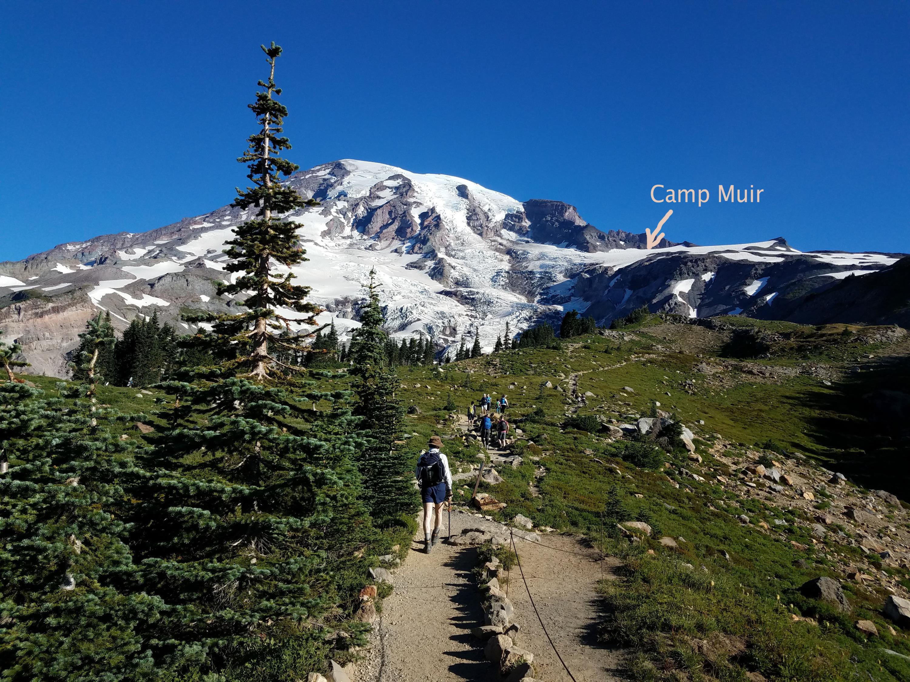
Skyline Trail up to Pebble Creek is one of the most popular hikes from Paradise. It’s about 1800 feet of elevation gain (from 5400 feet at Paradise up to 7200 feet) in around 2 miles. We maybe stopped once but we were up to Pebble Creek very quickly. We took a break there to refuel, change our clothing a bit and get ready for the snowfield.
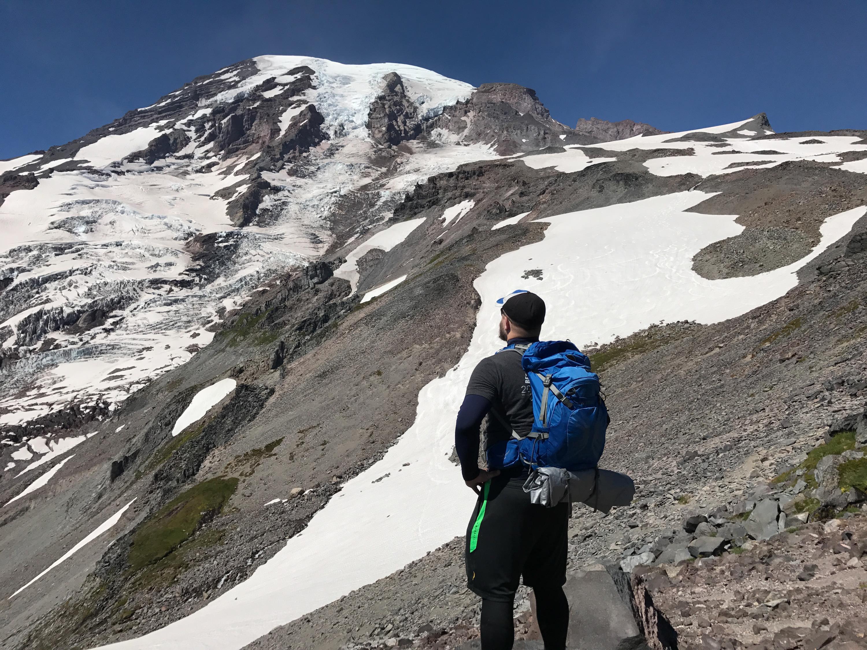
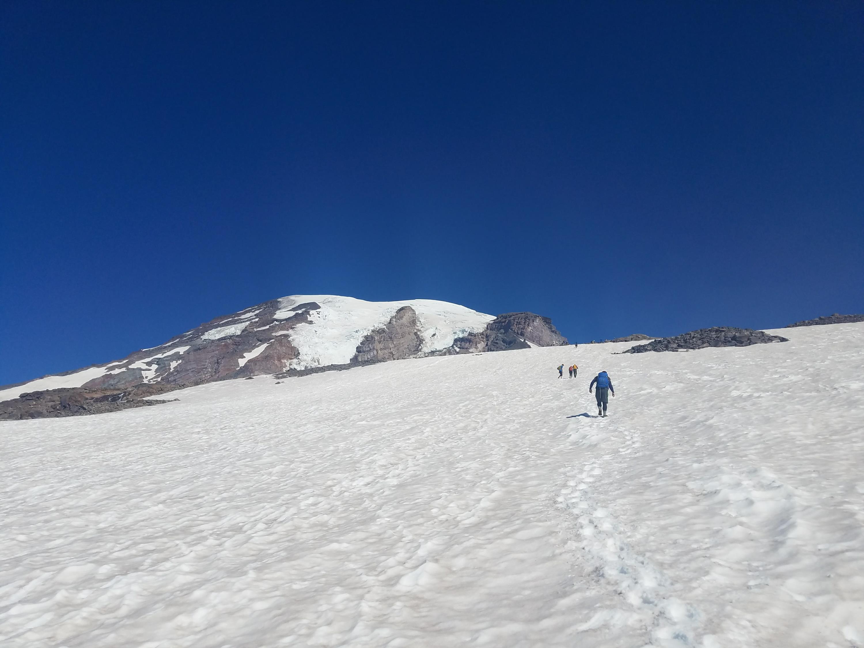
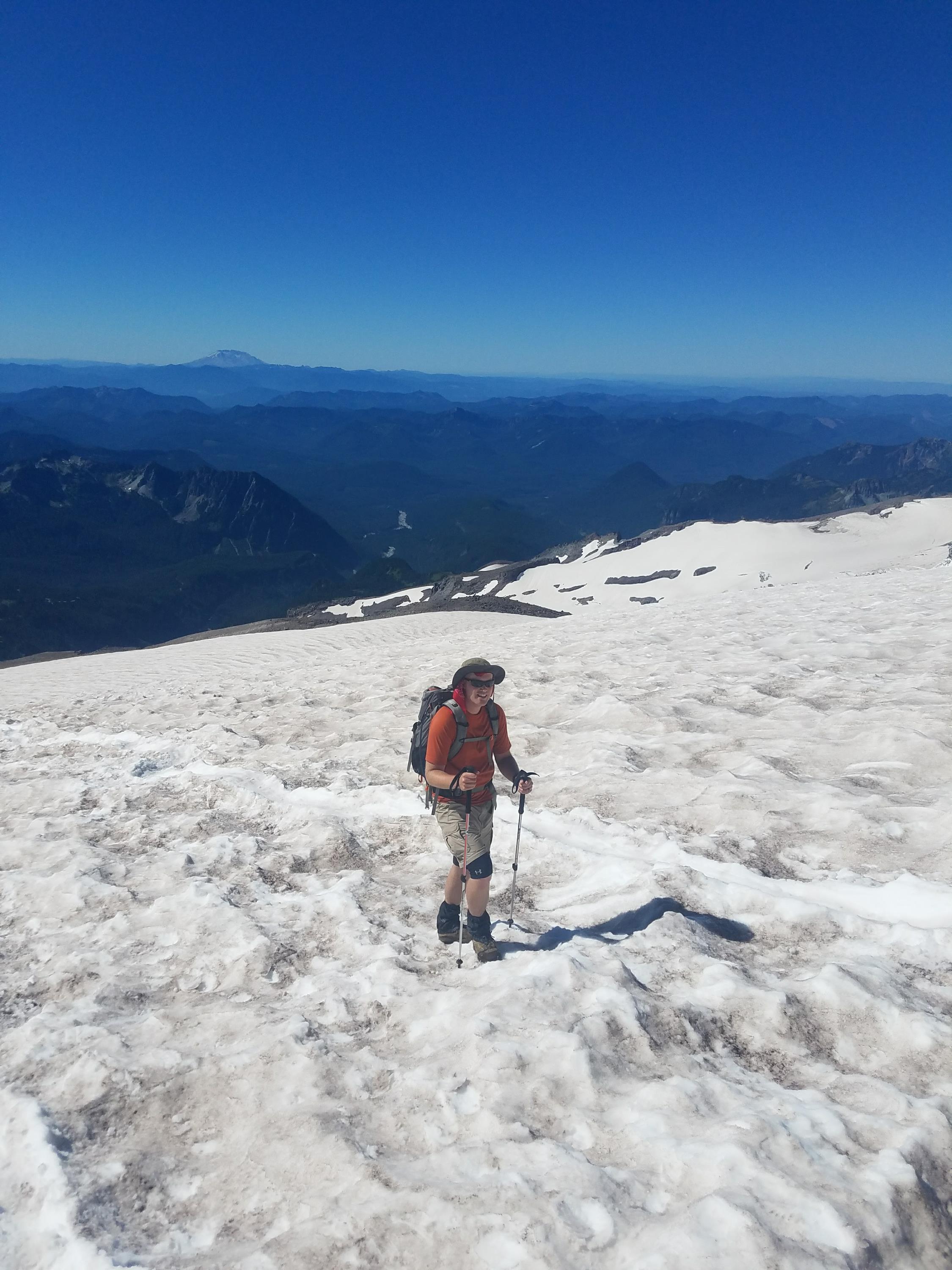
From Pebble Creek, the route goes straight up the Muir Snowfield. It’s about 2.2 miles and 2800 feet up to Camp Muir from Pebble Creek. And it’s on snow. And the snow is slushy from the sun. And oh yeah, you’re going up over 10,000 feet so you rapidly start to notice the decreased lack of oxygen.
At this point we spread out a bit, set our own paces and got in the zone. It’s hours of staring at your feet, concentrating on your breathing, and taking tiny little steps up the mountain. I don’t know what the “hardest day hike” in the area is, but this has to be a solid contender. In addition to the physical challenge, the immense scale is psychologically frustrating. You put your head down, slog away for 20 minutes, look up and realize that your goal doesn’t look any closer than it did before.
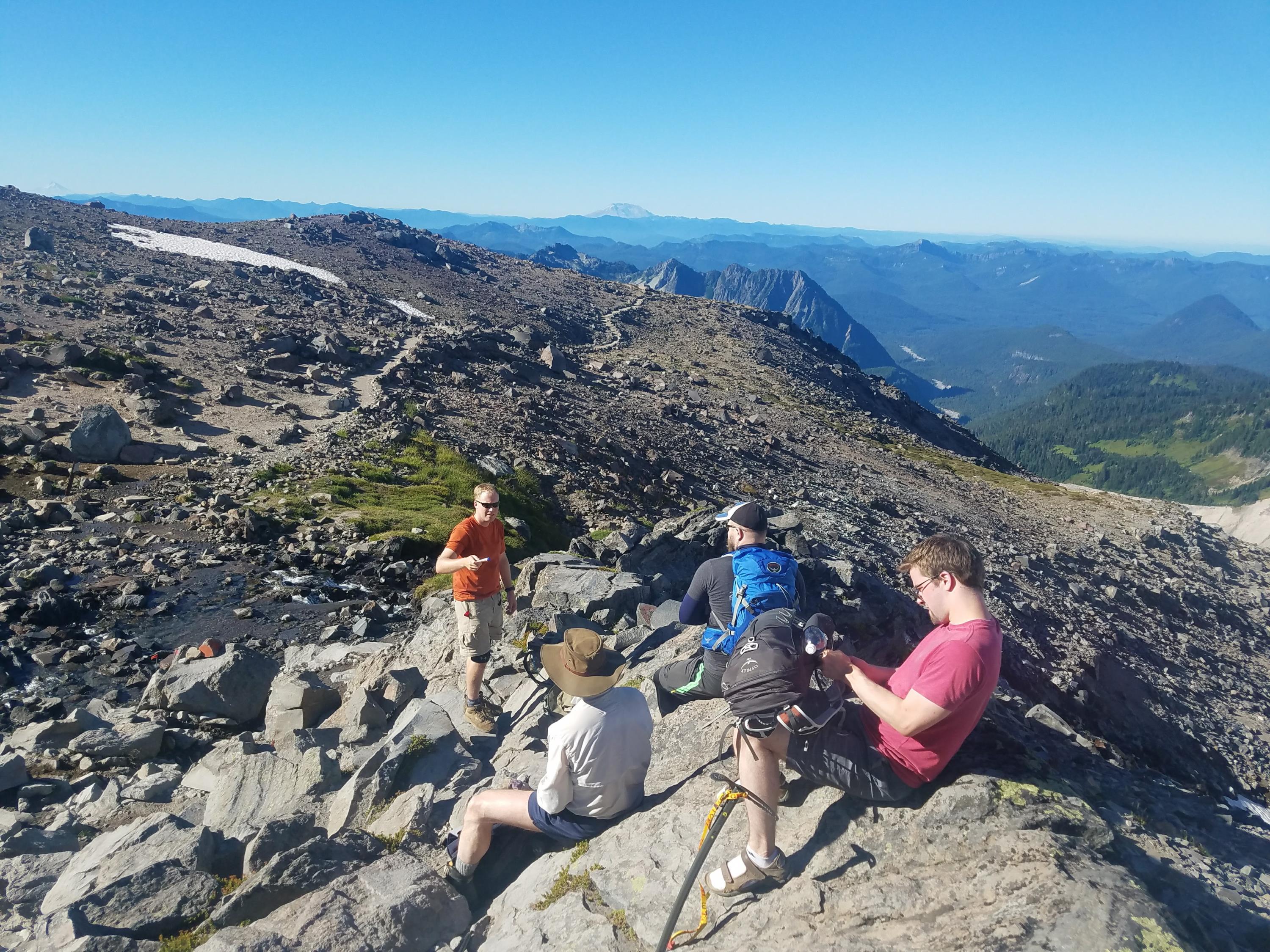
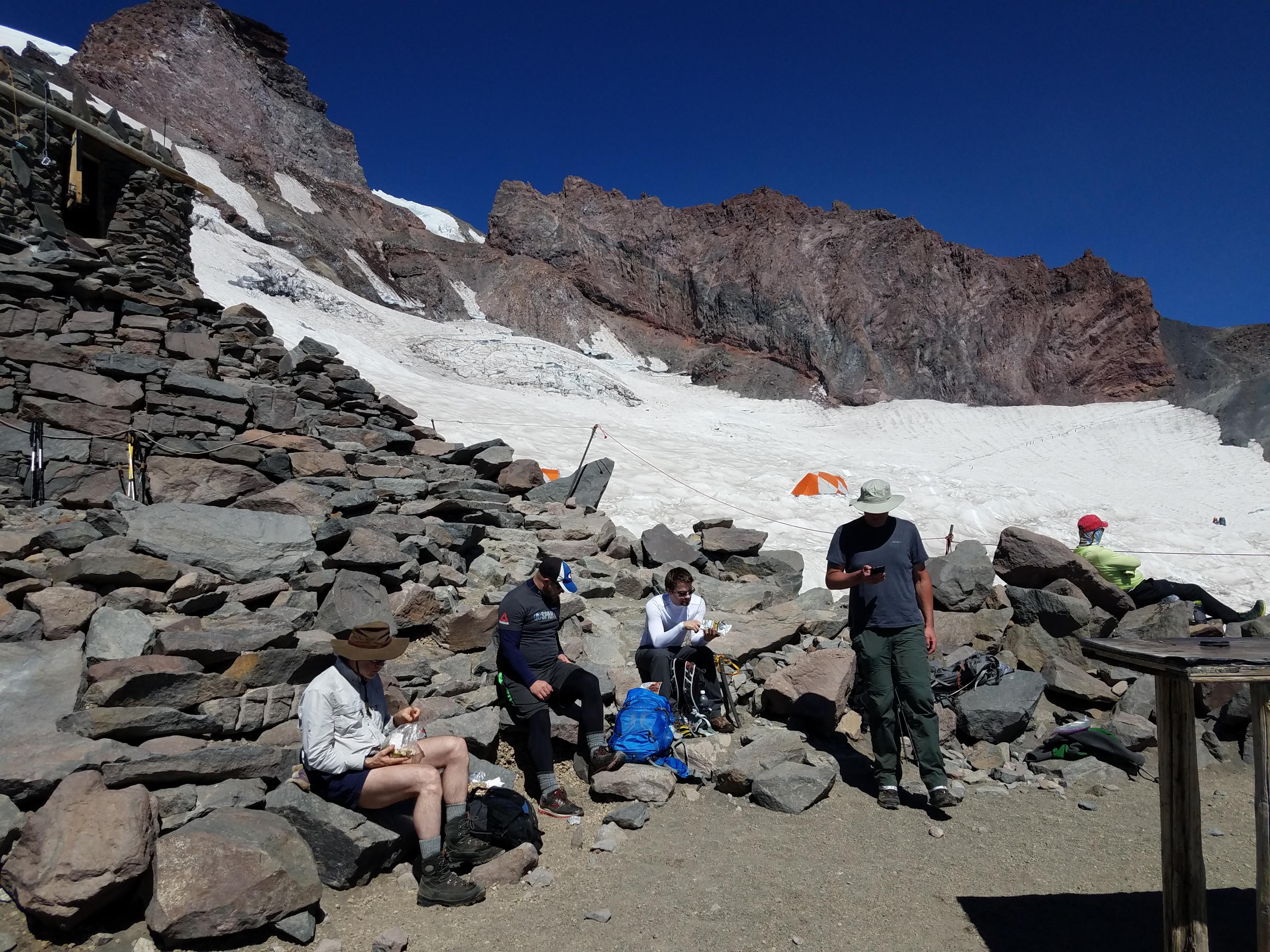
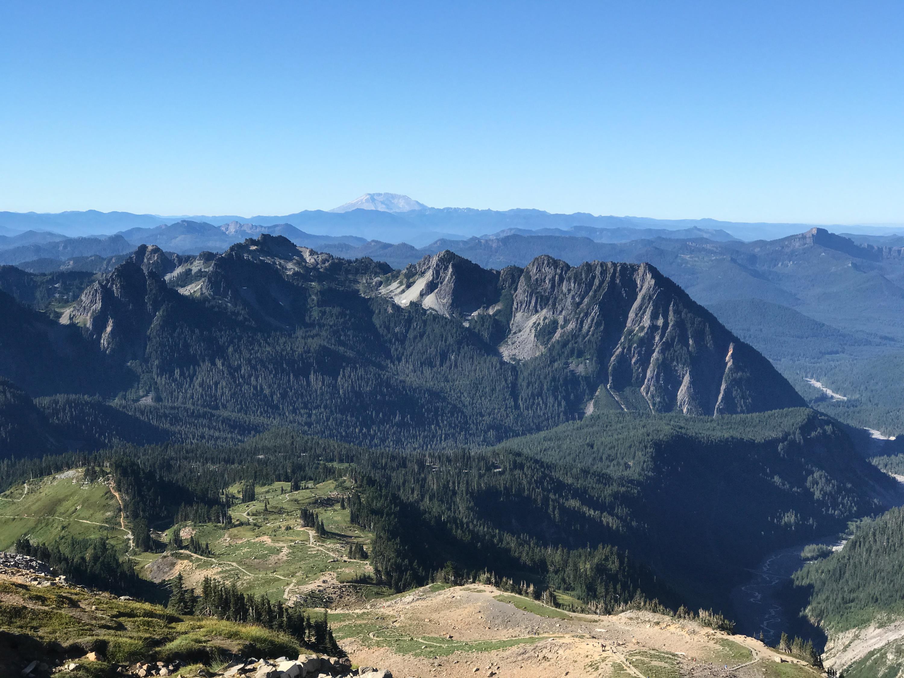
But we all made it! Logan was first up with a total time (from Paradise) of 3:26. He probably could have shaved off another 10 or 15 minutes but he stopped to wait for us at one point on the snowfield. Pastor and I clocked in right at 3:30 and Dave and Tim came in at the 3:45 mark. My previous time was 4:10 so I was very happy to beat that.We hung around at the camp for about an hour enjoying the incredibly clear views. Mt. Adams, Mt. Hood, and Mt. St. Helens were clearly visible. The temps were perfect and there wasn’t a lot of wind. I couldn’t have dreamed up better weather.
Eventually we made our way back down the mountain. We all brought something to slide on. Most of us brought trash bags but Dave had snowpants (the smart choice) and Pastor had a tarp. Glissading down was fun for a while, but it was pretty painful. The chutes were all too narrow and the icy sidewalls would hammer our thighs. We got pretty soaked in the process too. But it sure beat the effort it took to go UP! The video below is not representative of most of the glissading. This one was right near the bottom so it was well-used and dug out by people who just came up to see the snow.
After another stop at Pebble Creek to switch into some drier clothes, we hoofed it down to Paradise dodging the enormous hordes of people who had made it to Paradise and were exploring the trails.
I’m really happy with how good my muscles felt after the hike. I had very little soreness aside from the bruising caused by the glissading. The worst part was that I think I got some altitude sickness this time. Thankfully it didn’t hit me until we were resting up at Muir. I had a bad headache and started feeling nauseated and lightheaded. The latter two went away as we descended bu the headache stuck with me well into the night.
In my blog post on the last hike, I had some good notes that were helpful for planning this trip, so here are a few more notes in case I do it again:
I used about 3-3.5 liters of water. Last time I used 5. I think 4 would be a safe amount. I used two Camelbaks and had a half gatorade, half water mixture in one. I would do that again.
I threw some summer sausage, cheese and crackers into a cooler with extra gatorade and water. That was a huge hit when we got back to the truck.
Getting on the trail around 8 felt like good timing. There were plenty of people who left ahead of us, but it was not too crowded. On a weekday you could probably leave a little later, but on a weekend, stick with 8 or earlier.
I took a bandanna with me and suck it in the back of my hat. It did a great job keeping the sun off my neck.
Thanks to Logan for suggesting this and to all the guys for banding together to make this a reality. It was awesome to see Logan beating us all up the mountain. Two years ago I don’t think anybody would have believed he could get in such good shape in such a short amount of time. Kudos to you Logan!
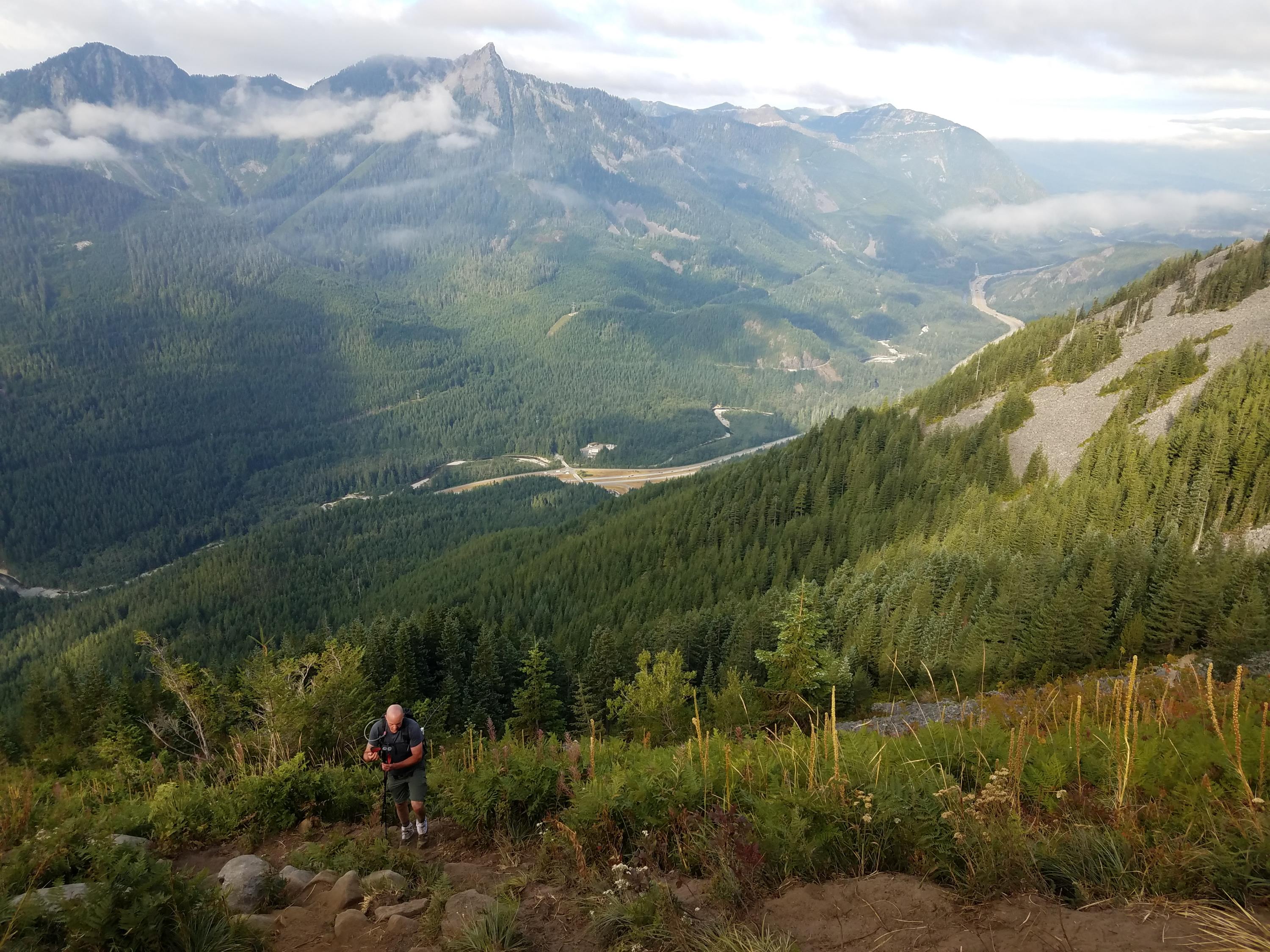
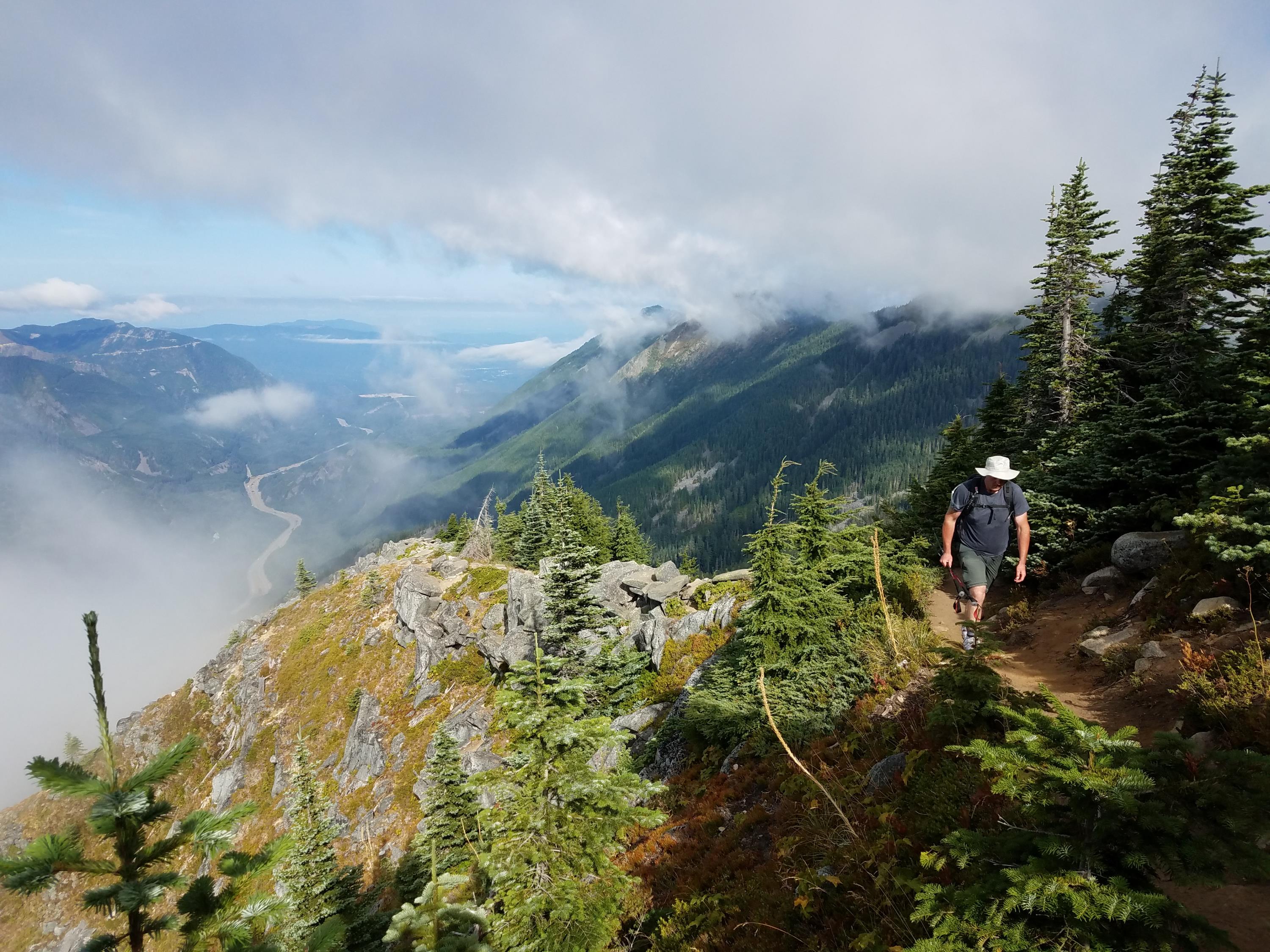
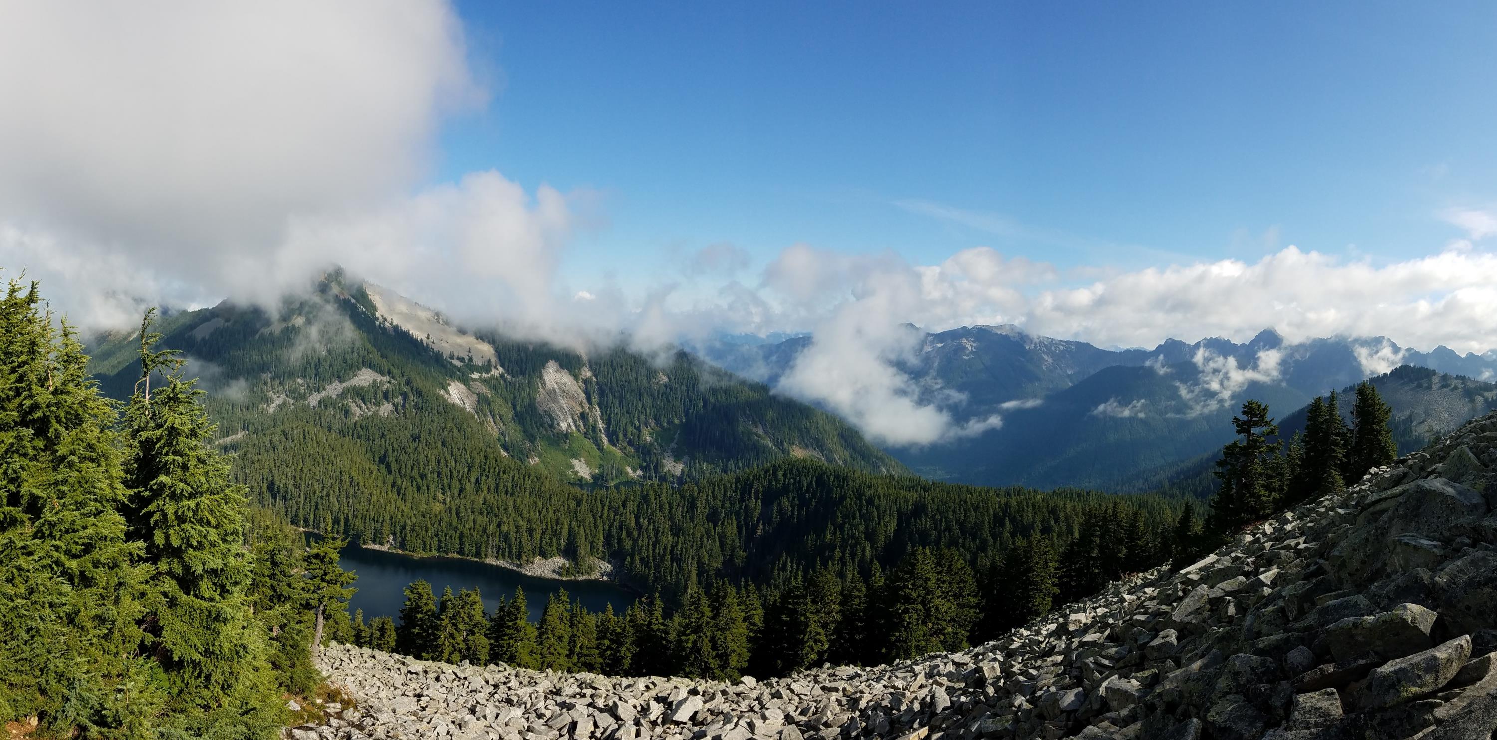
Saturday is our first attempt at Camp Muir (depending on the weather) so Logan and I wanted to squeeze in one more hike. We went for Mason Lake because it wasn’t too far away and it was relatively easy. The trail climbs up to the top of a ridge and then drops down a couple hundred feet to the lake. We were almost the first ones to the lake again (another guy beat us by a couple minutes) and we got to enjoy it in peace before the crowds came up behind us. We made it there very quickly with only one stop to remove our pant legs and convert to shorts. Since we were still feeling fresh and it was only 8:30am, we decided to take another fork of the trail and go up to the top of Little Bandera Mountain.
Whew. It was STEEP.
My GPS watch has been pretty accurate on our hikes and it reported 980 vertical feet over 0.6 miles. The trail isn’t traveled very much and after just a little bit, the trail builders obviously gave up on the switchbacks and just went straight up the hill. It was a slog but we made it scrambling up on all fours. I included a chart from our trip in the photos below. You can see the hike up to the peak and notice how much slower we went on that part with frequent stops. The third picture was also take on that steep slope but it’s always hard to see slope in a photo. Just note how close Logan is but yet how much lower he is! You can click on any of the pictures for a bigger view.
The view at the top is supposed to be incredible with Mt. Rainier standing proudly for you to enjoy. Unfortunately there were a lot of clouds to the south, but the view to the north was great. We looked down on Mason Lake where we had been earlier that morning.
All in all it was a great hike and hopefully we’ll be ready for Camp Muir on Saturday!
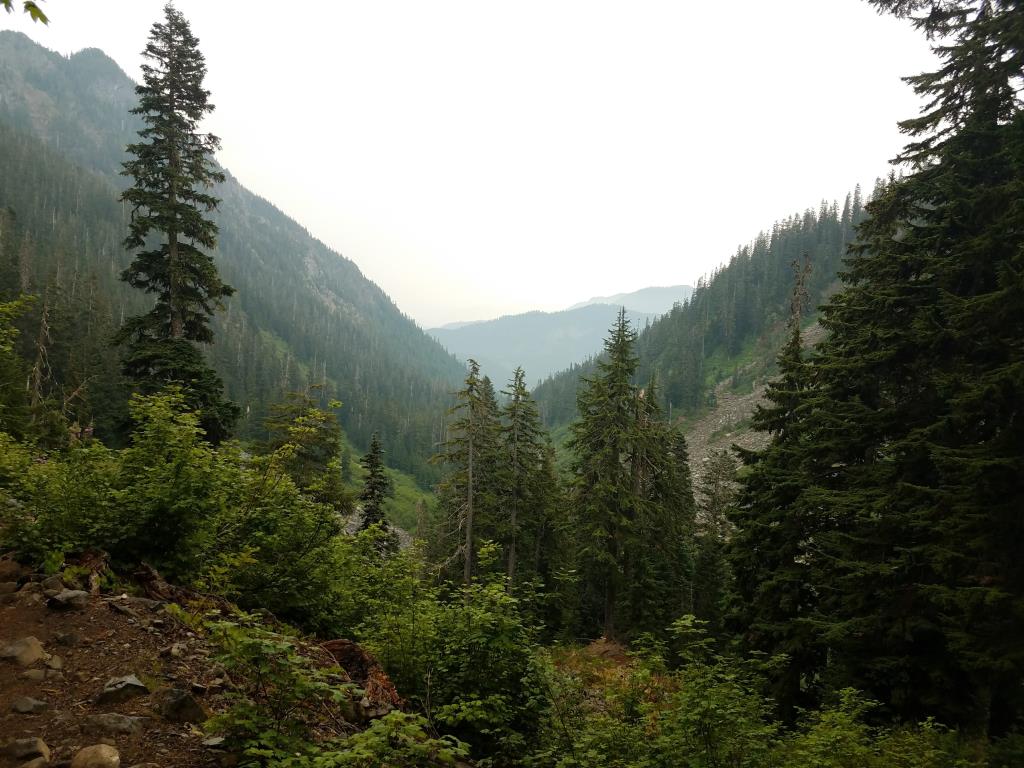
Our hike up to Camp Muir is getting drawing near. Logan and I have been doing quite a few hikes this summer to prepare and last Saturday it was Lake Melakwa. We had originally planned to attempt to get to Mailbox Peak (one of the hardest local hikes) but given the smoke, we decided to do something that didn’t require clear skies for the payoff at the top.
It’s a good thing we switched to Lake Melakwa. Even though the smoke had started to blow out of the area, there were a lot of clouds and even a few raindrops on our windshield as we drove there. (We haven’t had rain in 56 days!) Mailbox Peak almost certainly would have had a disappointing view at the top.
We left my house at 6am, hoping to get to the trailhead before this incredibly popular hike got super crowded. The early start paid off. We hit the trail at about 7:10 and we were the first ones up it. That meant we got to clean out the spider webs but it also meant that we didn’t see a soul until we got to the lake!
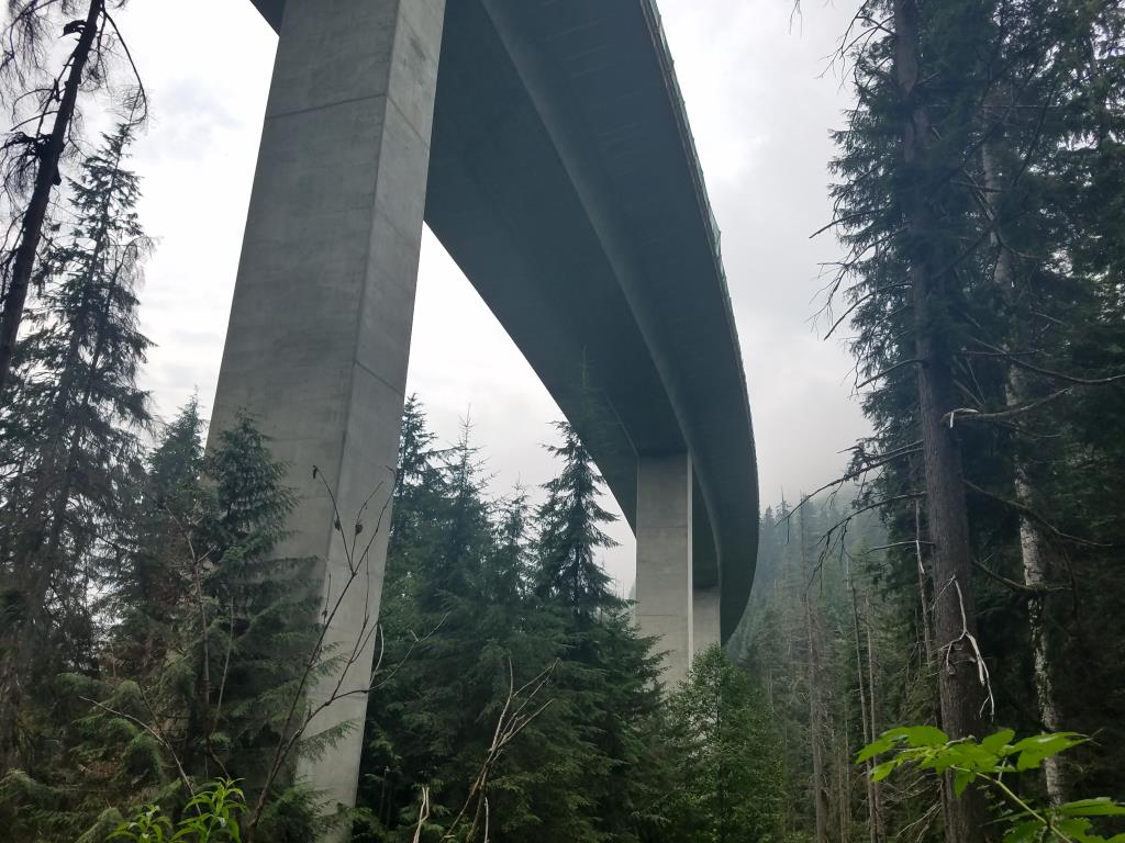
The hike was gorgeous. I can see why it is so popular. You cross Denny Creek a few times both with bridges and without. You walk under the enormously tall I-90 raised roadway and there is a fairly tall waterfall. Even if you just went a mile up the trail to “waterslide rock” to let your kid play in the water, I’d still say it’s a worthwhile hike.
It’s around 9 miles roundtrip with 2500 feet of elevation gain. On the way up, I felt like the trail was relatively smooth, but on the way down I really noticed all the rocks on the upper part of the hike. It’s not nearly as rocky as a hike like Pilchuck though. And while Melakwa is the Chinook word for mosquito, we only saw a handful of bugs. There was a pretty constant light rain at times on the hike so maybe that kept them at bay.
The views on the way up were great but wow, that lake is gorgeous! We made it up in just a shade over 2 hours. We were the only ones there except for a couple overnight campers across the lake. A few groups were only 5-10 minutes behind us though.
I don’t know exactly what my top 3 hikes in the area are, but this is probably one of them. The only catch is that you really should get there by 7 or 7:30. When we left there were an incredible amount of cars there and hiking is so much better when you have some solitude! Not to mention that it’s better when you can park right by the trailhead instead of adding a mile to the hike so you can get to your car.
You can view our trip stats on the Garmin site. It’s a little screwed up because I forgot to stop it until about 10 minutes down the road.
Logan, Tim and I met up early Saturday morning for a hike up Mt. Pilchuck. This hike has been on my list for a long time. There is an old fire tower lookout at the top of the hike and it has a fantastic view. (Duh, that’s what fire towers are for.)
The top of Mt. Pilchuck is over 5000 feet but thankfully the drive up to the trailhead takes you a good portion of the way up the mountain leaving only about 2200 feet for the actual hike. Be prepared though because that road includes about 6 miles of dirt road and some of it has very big potholes. I was happy to have the truck.
We got to the trailhead at 8am and had no trouble finding a parking spot. I’d say the actual lot was about half full. There were plenty of bugs in the parkling lot and on the whole hike, but they weren’t much of a problem unless you stopped walking. And even then they were just gnats, not anything that would bite.
We made good time heading up and the trail was nice, but the view at the top was a bummer. It was totally encased in a cloud. Coupled with wind and chilly temps, it wasn’t an inviting place to stay so we quickly came down from the tower and found a calmer spot to eat our food. The hike down actually took longer than the hike up because we had to stop for the hordes of people heading up the trail.
The elevation and distance aren’t too much to handle, but the trail gets it’s difficulty rating from the constant rocks. You have to watch where you put every step or you’ll add to the large number of people who sprain or break ankles. The climb up to the tower (pictured below) is the most intense part. Be prepared to scramble on all fours, or as one guide book put it, “minor acrobatics are required.”
All in all, it was a good workout and prep for Camp Muir, but I want to go back again to witness the view. You can view the stats from our hike on the Garmin Connect site.
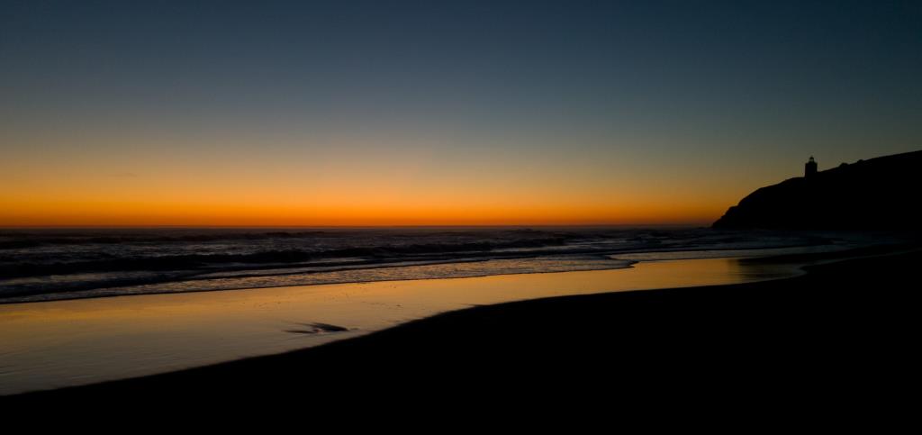
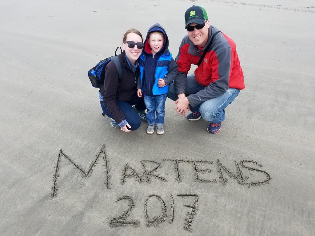
Last weekend, we headed down to Cape Disappointment State Park in the very southwest corner of the state. Don, Nancy and Megan had a campsite for their trailer and Logan, Tyla, Elijah and I stayed a short walk away in a tent site.
This was only Elijah’s second camping trip in the tent and he did great! He went to bed around 9:30 every day (about 1.5 hours later than normal) and slept solidly all night until pretty far into the morning. It definitely gave me confidence to do some more trips with him.
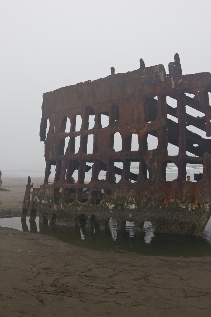
The park itself was really nice. The beach was huge, sandy and perfectly positioned for beautiful sunsets. There are a lot of other parks nearby and we went across the bridge into Oregon to check out the 1906 shipwreck at Fort Stevens State Park.
The only major bummer of the trip was traffic. We left at 2pm on Friday for the 3.5 hour drive. It took us 5.5 hours (plus 30 minutes of stops) to get there. We only hit an extra 30 minutes of traffic on the way back but it all came in one big messy accident backup.
I was very impressed with the camera on our Galaxy S7’s. All of the pictures you see below were taken on our phones except for the shipwreck. It’s gotten to the point where I feel less and less of a need to lug the big dSLR around with us. It still has its uses, but I don’t feel nearly as bad as I used to if I forget to bring it along.
A huge thanks goes out to Don for doing all the heavy lifting when it came to meal times!
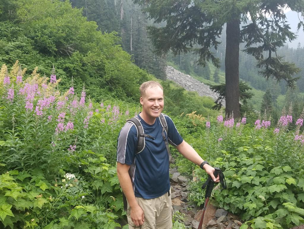
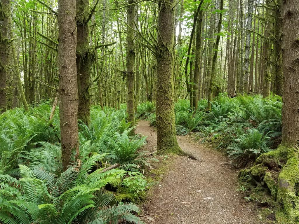
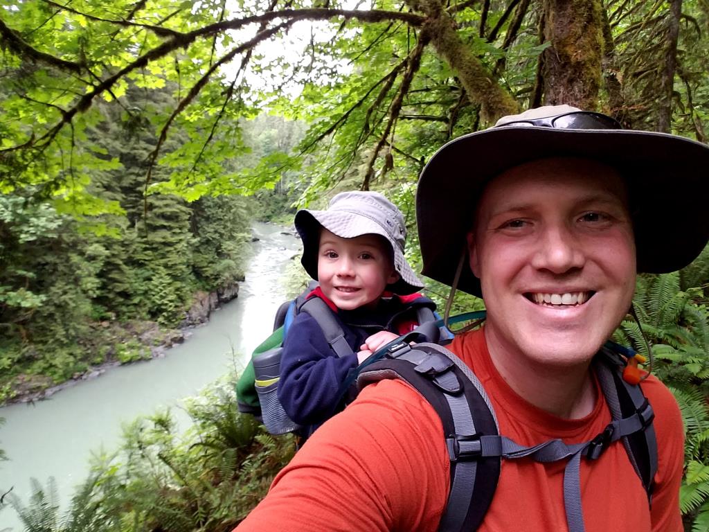
After the success of our Little Mt Si hike, Logan, Elijah and I headed out again. We picked out a very kid-friendly trail so that Elijah could spend a lot of time on his feet instead of in my pack. That worked for about half a mile and then he rode the rest of it. I didn’t push it because he seemed legitimately tired (he was falling asleep in my pack) but it worked out fine. The trail doesn’t have a lot of elevation gain but it is 8 miles round trip.
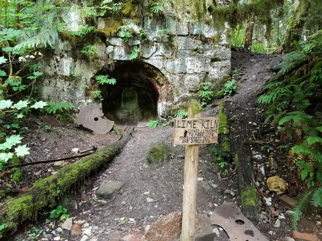
There isn’t a huge payoff but the walk is pretty. You go past an old lime kiln and then in another mile you hit the end of the trail at the edge of the river. We had lunch there and made our way back.
The trail itself is indeed kid friendly. It’s generally fairly wide and relatively smooth. There were, however, a lot of bushes and trees growing in from the side of the trail so you have to be careful not to smack people in the face behind you. It was especially tricky with a kid riding in a backpack.
I really enjoy these hikes but I’m struggling with how to keep Elijah engaged at this transition point. I don’t love hiking without a destination, but a lot of the destinations that are fun are also more than he can handle at this point. If you have suggestions of waterfalls, lakes, fire lookouts, etc that are only a mile or two round trip without a ton of elevation gain, please send them my way.
In addition to the pictures below, you can also see the hyperlapse that I posted on Instagram. (A hyperlapse is basically a video that is sped up and smoothed out so it kind of looks like you’re flying along without the normal video bumps caused by walking.)
On Saturday, Logan, Elijah and I headed up Little Mt. Si. Tyla messed up her ankle a bit and decided to stay home. We got to the trailhead at 9am and there was already no parking. Thankfully someone pulled out right as we pulled in.
It’s too much hike for Elijah to do all on his own so I packed him about 3/4 of the way up and then he walked about 2/3 of the way down. He’s technically still under the weight limit for the carrier we have but wow, that’s a load. It’s funny though that carrying him doesn’t seem as heavy as when I used to load a couple water jugs in my pack to train. I think it’s because I always knew I could stop and pour out the jugs.
It was my first time on the hike and I enjoyed it. The trail was packed since it was a nice day and there is still snow on a lot of the higher elevation trails. We were on our way down before the big rush came, but we had plenty of company at the top of the mountain. The view, unsurprisingly, isn’t as great as it is from the top of Mt. Si, but it was still nothing to scoff at.
Thanks to Logan for suggesting a hike and picking it out! Hopefully there are a lot more hikes coming up this summer.